
The following article has been converted to HTML format.

Wing Tips, December 1988
SATELLITE NAVIGATION AND INSTRUMENT
LANDING SYSTEM TESTED IN THE SAAB 340
Unlimited applications envisaged, according to Hakan Lans, Swedish system specialist.
The first Saab 340 Satellite Navigation flight took place on 14th October, in the wee hours of the morning, at the Saab airfield in Linkoping.
Pilots were lngemar Danestig and lvar Lundström, and the cabin was filled with representatives from the media, in addition to the technical people involved.
Hakan Lans, who runs his own engineering business, has been working on this airborne application of the Global Positioning System for several years together with Magnavox in the U.S.
An avid pilot himself, he wanted to develop a light-weight system at reasonable cost, that could be used not only for positioning but also for approaches.
The Global Positioning System (GPS) is a satellite-based radio navigation aid developed by the United States government. Today there are six experimental satellites orbiting the earth; in 1992, when the system is scheduled to be fully operational, there will be another 18 satellites, providing global navigation capability 24 hours a day.
The system is based on the accurate measuring of time. Each satellite has an atomic clock with a precision of 10 14 i.e. a deviation of one second in three million years !!
Each satellite transmits its position, plus a time code, to a receiver on the earth.
If the receiver knows when the signal was sent, it can calculate the distance to the satellite.
The distance itself is of little use; neither can people carry atomic clocks in their pockets to ascertain when the signal was sent.
What we need is several satellite signals, plus a unit that corrects certain parameters. With four (or more) satellites transmitting at the same time, we can make an equation, solving four unknowns: latitude, longitude, altitude and time.
Each satellite also transmits its own position with a special code.
Let's look at the system structure, using four satellites for illustration:
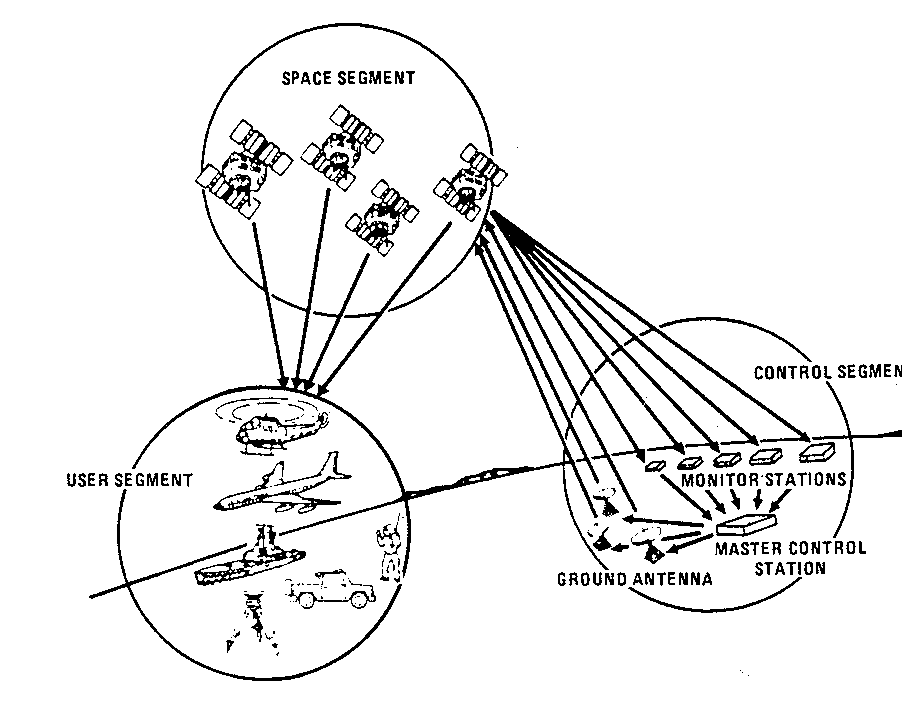
There are three parts:
a space segment (i.e. the satellites);
a control segment (master control station plus monitor stations); and
a user segment (cars, ships, aircraft, pocket receivers).
The satellites transmit signals to both the control segment and the user segment. They also receive signals from the control segment (see picture).
To the control segment they transmit:
orbital characteristics (ephemerides);
satellite time;
navigation signals;
In return, they receive from the control segment:
corrected ephemerides;
satellite constellation almanac;
corrected satellite time.
(Time used is GPS System Time).
They can now transmit to the user segment:
corrected ephemerides;
satellite constellation almanac;
navigational signals:
"health data".
A few explanations:
The ephemerides describe the detailed orbital characteristics of the satellite from which it is transmitted.
The satellite constellation almanac, as transmitted from the control segment to the space segment and relayed to the user, describes the coarse orbital data for all of the satellites in the constellation. This data is broadcast to the user segment so that it can be stored and used for initial satellite acquisition and for satellite visibility prediction.
The "health data" will indicate the quality of the navigation signals; the status may be displayed by the user's equipment.
The present six NAVSTAR satellites (NAVigation System with Time And Ranging) circle the earth in nominally 20,000 km (10,900 nm) orbits. The orbital geometry is six 551 inclined planes, with three satellites in each plane. Each satellite has an orbital period of 12 hours.
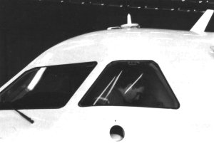
The temporary antenna installation on the crew escape hatch
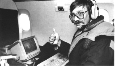
Hakan Lans during the approach trials
This satellite constellation provides a coverage of at least four satellites at any point on the earth's surface for four to five hours each day. As mentioned, when fully operational, there will be 24-hour global coverage.
Let's have a closer look at the user segment.
It may consist of ground-based, marine, airborne or spaceborne GPS receivers/processors. The receiver/processor selects four satellites to track that provide the best geometry for accurate positionlnavigation solution.
As the satellites continue their orbits, the receiver/processor drops each satellite with marginal geometry as a satellite with better geometry becomes available, then tracks the better satellite.
The receiver contains a crystal reference oscillator for timing purposes. It is located in an oven (temp. +80'C) to give the required extreme accuracy. A stabilized oven temperature is of vital importance.
The oven has a warm-up time of roughly 15 minutes. Then the system is calibrated against the satellites' atomic clocks; total preparation time is at present approximatey 45 minutes.
Another important requirement is that of an unobstructed antenna, i.e. there must be a free line of sight between the antenna and the satellite.
For airborne applications, this presents no problem, but a car driving through a tunnel would lose contact.
Accuracy is today circa 10 m horizontally and 10-15 m vertically. With so called differential GPS, accuracy to within a few centimetres is possible. Differential GPS uses two receivers, one stationary at a known position, and one moving. The two are linked by a real-time communication link and, by knowing the location and the satellite range, corrections can be made.
ILS approaches performed at Saab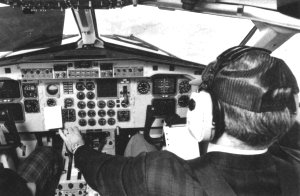
lvar in the right seat during one of the approaches
As mentioned, approaches have already been performed in a Saab 340. The GPS system was hooked up to the copilot's navigation equipment, using the normal EFIS instruments for presentation.
The flight lasted for about one hour, and several approaches were made, both manual and with autopilot.
lvar Lundstrom, who was in the right hand seat during the flight, says that everything went "as smooth as silk". lngemar Danestig compared the left and right displays during the approaches and says that "you could hardly notice that another system was hooked up on the other side".
- This is surely a milestone, from a pilot's point of view, both of them agree.
Unlimited applications
Dr. Tore Gulistrand, former president of Saab Aerospace Division, and now working on the Saab-Scania group level, is the initiator of the GPS tests in the Saab 340.
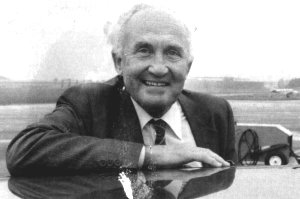
Dr. Tore Gullstrand
He points out that GPS is going to be used on all kinds of moving vehicles, in the air, on the sea and on land. In Saab-Scania, GPS systems have for a long time been installed in helicopters, including those which will be used in the Swedish Antarctic expedition this winter.
- We are shortly going to install GPS equipment in automobiles and trucks for navigational purposes, he adds.
Hakan Lans and Tore Gullstrand can see a lot of applications for the system.
- All present navigation and
landing systems can be replaced. Cars, ships and other vehicles can be equipped with GPS. All you need is an unobstructed antenna.
- As far as approaches are concerned, this system will be ideal for airports where there are diffulties in installing, for instance, an ILS, due to interference from the surrounding terrain etc.
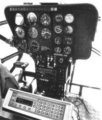
Antarctic helicopter installation
- Also, the system can be used for traffic avoidance, so the TCAS application should not be forgotten, says Hakan. - And, just imagine you are driving a taxi, and someone jumps in and asks you to go to "Quaglebush Road 34". Instead of looking it up in a book, you punch it into your little computer, which will then display the position of that address on your display. Your own position, plus the city road system, is also displayed, so all you have to do is drive the nearest way to the address given. Your progress is displayed all the time. - A car antenna needs not be bigger than a coffee saucer, says Dr. Gullstrand (see picture).
(Facts and figures courtesy H. Lans/Magnavox/Dr. Gullstrand).
Press clip as MS WORD dokument