The following article has been converted to HTML format.

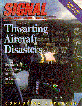
Front-page in US Magazine SIGNAL, February 1995.
Air Navigation’s Future Rests on Satellites, Microprocessor
Air Mobility Command uses a global positioning and communication system on air drop flights.
By Clarence A. Robinson, Jr.
A revolutionary new global positioning and communication system from Sweden is providing precise air traffic and military command and control capabilities. This advanced system uses satellites for positioning down to a few meters accuracy without the need for radar and radio navigation aids.
Swedish officials believe that the global positioning and communication (GP&C) system can provide collision avoidance from runway incursions by aircraft and ground vehicles that are in the wrong place at the wrong time. Equipping military, commercial transport, business and private aeroplanes as well as ground vehicles with transponders enables controllers to know exactly where all airport traffic is located at any time. Alarms automatically can be activated if the danger of a collision is present, the officials add.

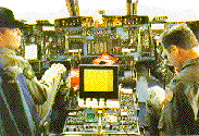
U.S. Air Force C-5 transport pilots monitor the cockpit display of data from the global positioning and communication system during formation flying for a brigade-size air drop. The navigation system's performance provides accuracy in position to less than 1 meter,. direction to within 0. 1 degree; speed to 2 knots; and altitude to 16 feet The display provides aircraft identity, position, heading, attitude, altitude and prediction fine.

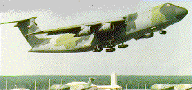
A U.S. Air Force/Lockheed C-5 Galaxy transport takes off on a mission. Up to six of the aircraft are being flown in formation equipped with CeisiusTech's global positioning and communication (GP&C) system for brigade-size air drops. The system's real-time navigation accuracy is down to 1 meter with the location of each aircraft using GP&C displayed in the cockpit of every user via data link.
Each system-equipped military or commercial aircraft transmits the user's own position and receives, via digital data link, the accurate location of all other users for display on cockpit screens. At the heart of this global navigation satellite system is an advanced algorithm and a singleboard-microprocessor communications computer.
CeisiusTech Systems' GP&C system involves equipping aircraft, ground vehicles or ships with a transponder.
The GP&C transponder includes a commercially available global positioning system (GPS) receiver, the communications microprocessor and a radio transceiver. A sophisticated algorithm integrates and drives the system. CelsiusTech Systems is based in Järfälla, Sweden.
The U.S. Air Force already is using this new navigation system on its giant Lockheed C-5 Galaxy transport aircraft flying close formation day, night or in adverse weather to provide highly accurate aerial cargo delivery, according to Lockheed program officials.
The GP&C system also is being demonstrated by the Swedish Civil Aviation Administration (CAA) to show the location of aircraft taking off, landing and taxiing. Additionally, ground vehicle positions also are being precisely displayed to avoid runway incursions.
Sweden's CAA officials contend that large-scale test of the communication, navigation and surveillance system at Gothenburg/Landvetter Airport verifies and successfully demonstrates the concept with performance reliability and predictability. U.S. tests were conducted at Chicago's O'Hare Airport. The system's very high frequency (VHF) time division multiple access (TDMA) data link in use for the trials will be the premise behind a network of base stations under development in Sweden and Denmark.
The GP&C system was demonstrated for SIGNAL by FFV Aerotech AB officials in Lindkoping, Sweden, using a tactical map drawing unit display system called TMAP. This system enables real-time presentation of two-dimensional vectorized planar maps. TMAP, which also provides three dimensional perspective scenarios and tactical information, text and graphic symbols, can superimpose bit map information, video images or radar in overlays.
The transponders for the GP&C receive positioning data from GPS satellites. Ground-based differential GPS input from surveyed sites also can be used further to enhance accuracy to approximately I meter. The higher degree of differential GPS accuracy rests on correction factors on the transmission network, calculated in a dedicated piece of equipment, a differential transponder. The differential transponder's fixed and accurately known position is broadcast over the network. The range of differential transponders can be extended using repeater stations.
Each GP&C user's position is transmitted on a pre-determined radio channel in the VHF band to all other aircraft located within radio range. A graphic cockpit display shows the position of each aircraft together with its identity and a symbol designating course and speed. Each user can locate every other user at any point in time.
The use of the TDMA principle is a key to allowing all of the GP&C transponders to transmit over the same channel. Highly accurate global time synchronisation is offered by cesium clocks onboard NAVSTAR satellites. This makes it possible to divide the time into millisecond slots, allowing each user's transponder to transmit in its own time slot.
Nationwide radar networks or special airport radar systems, including ground radar, no longer are necessary with GP&C, according to CelsiusTech officials. These officials, who grant that the claim is provocative, also contend that microwave landing systems (MLS), instrument landing systems (ILS) and identification friend or foe (IFF) are unnecessary when using GP&C.
The U.S. Air Force asked Lockheed Aeronautical Systems Company C-5 program officials in July to recorrunend equipment that would support a flight test of six transport aircraft flying in formation for a brigade-size air drop. Under an approximately $1 million contract with CelsiusTech, Lockheed has enough of the transponders to install the GP&C system in eight of the Galaxy transports. Formation flight testing is under way with equipped C-5s. Each aircraft, with its 223-foot wing span, flies at the same altitude at a 2,000-foot separation. Air drops are being accomplished with the aircraft at various flight levels using the GP&C system, Lockheed officials state.
Until the GP&C air drop tests, according to Lockheed's C-5 program officials, no more than two of the transports had been flown in this type of close formation. With the retirement of the company's C-141 transport aircraft, the flight tests are very important to establish the C-S's aerial cargo parachute delivery capability. The C-5 tests are designed to assess the accuracy of the air drops using large aircraft in formation.
Before selecting the GP&C system, Lockheed looked at all the equipment available for station-keeping functions, so that each aircrew would know at any given time where the other aircraft are located in the formation. The initial problem, according to company C-5 officials, was to acquire the hardware and have it installed and working within a few months. This meant surveying the marketplace for a relatively simple, cost-effective, off-the-shelf system. The GP&C system immediately was available in Sweden. The patent for the system jointly is owned by CelsiusTech and the Swedish Space Corporation.
With the GP&C system, each aircraft in the formation knows its precise location and continually transmits its identification, position, altitude, course, speed and routine text messages via a digital data link. This enables each user to keep track of all other aircraft in the formation on a geographic cockpit display, a company official explains. The data transmitted and received are derived from the GPS system without a required connection to other aircraft avionics, such as an inertial navigation system.
Air Force and Lockheed officials initially tested the GP&C system in Sweden. Lockheed, company officials maintain, is supporting the C-5 air drop tests and believes the equipment is outstanding. However, no corporate plans exist to equip the C-5 fleet with the system. The GP&C system, however, can be used by a variety of aircraft, Lockheed officials add, for missions such as in-flight refueling. They admit that there is wide-scale potential application for use of the GP&C system, which slides easily into a rack and needs only a 28-volt direct current power connection.
The GPS receivers, antennas and computers were delivered to Lockheed by CelsiusTech. The system was assembled in Georgia and shipped to Dover, Delaware, for aircraft installation. One of the VHF antennas already mounted on the C-5 is being used in the air drop demonstrations.
U.S. special operations commands also have expressed interest in the GP&C systems and have asked for technical information and briefings, Swedish officials claim. A number of other U.S. federal agencies have expressed similar interest in the technology. Tactical applications for use on rotary-wing aircraft, ships at sea and main battle tanks also are being examined by military services.
Joint operations require coordination of fire power and mobility among different forces, making precision vital for a far greater impact, CelsiusTech officials assert. Using GP&C for joint operations can enable a tank commander to see exactly where all other tanks are located, where friendly attack helicopters are hovering in position and the range and direction of ground-attack aircraft approaching to provide close air support at a pre-designated moment.
The larger implications for the system, however, relate to worldwide commercial airline operations. During a 1991 International Civil Aviation Organization (ICAO) air navigation conference, a communication, navigation and surveillance (CNS)/aerospace and traffic management (ATM) concept was endorsed. This concept envisions the use of data link communications, satellite navigation systems and automatic dependent surveillance for air traffic management. This new global system is expected to provide the aviation community with a cost-effective replacement for current systems.
Design of a global system is still to be fully defined, and several international research and development projects are in progress to find out how optimally to implement a mixture of satellite technology and line-of-sight communication systems. The VHF TDMA data link demonstrated in the Swedish trials will be the basis for the network of base stations in Sweden and Denmark. This network, called CARDNET, is designed to enhance the system over a wide area and to provide users with gate-to-gate automatic dependent surveillance capability.
The Swedish CAA has been involved for several years in the development of such systems. One approach involved the runway incursion systems evaluation, and another project is CNS applications research and development, or CARD. Both projects are based on a global navigation satellite system transponder and a unique high capacity self-organizing time division multiple access VHF data link. Largescale CARD project tests were undertaken in Sweden last June.
A total of 29 global navigation satellite system transponders installed in both aircraft and ground vehicles took part in the test. Equipped platforms moved around in patterns to create real scenarios likely to occur at busy airports. The number of mobile units gradually increased with a very high data rate for both position reports and differential global navigation and satellite system corrections. These tests verified the functions of the data link in high load situations, according to the Swedish Civil Aviation Administration.
More than 14 years of research and development are involved in the GP&C system, notes Lars Bandling, who adds that this system was kept under wraps until abut 1988. He is vice president, International Planning & Analysis Center (IPAC), Arlington, Virginia. IPAC represents a number of foreign companies, including CelsiusTech in the United States. Bandling, a former Swedish air force test pilot, emphasizes that the secret for the GP&C system is in high-precision global time synchronization from satellites. An efficient use of the TDMA technique requires all users to be synchronized to the same time. The time signal from satellites facilitates this synchronization.
Bandling attributes the invention of the GP&C system to Swedish inventor Hakan Lans, who also invented a computer mouse and colorgraphic computers. A private pilot and aircraft owner, Lans initially designed the navigation system for private aircraft use, but the project grew much larger, with support from the Swedish CAA for application as ICAO's future air navigation concept. GP&C is one of two concepts ICAO is testing, and work within the future air navigation system group will determine how to move from ground-based to satellite-based navigation.
The GP&C satellite receiver also can be used for global communications with the Russian global navigation satellite system (Glonass) or with the international maritime satellite system (Inmarsat), Bandling continues. The mobile transponder includes a Magnavox engine, a six-channel, C/A code and continuous tracking receiver. The engine receiver uses carrier smoothing for improved accuracy. Position accuracy, he emphasizes, is typically less than 2 meters in the differential (D)GPS mode.
Bandling describes the communications microprocessor as the key element of the system. The single board microprocessor that implements the actual TDMA network includes the Motorola HD 64180 microprocessor and a Siemens SAB 82525 high level data link control communications circuit. The board uses a real-time operating system.
The TDMA concept, Bandling maintains, uses the time information available from the global navigation satellite system to divide each whole minute into a main time frame of 2,250 time slots. Each slot contains a 26.667-millisecond message that, in addition to the necessary synchronization and other communication overhead, includes identification information and a complete state vector including x, y, z position and velocity.
The time of the report also is included, along with a 1.66-millisecond silent zone to prevent overlap with other transmissions within a 250-nautical-mile range. The 2,250 different time slots per minute is considered ample for all users to transmit all position-related information, including altitude, course and speed as well as text messages.
The two-way TDMA data link is self-organized and operates at a transmission rate of 9,600 bits per second (32 bytes), with 255 different types of messages available. Only about 40 message types now are being used, Bandling adds. The data link can operate in either VHF or in ultra high frequency (UHF) using 25-kilohertz channel spacing. In the prototype transponders being used, position information is broadcast on a data link at the VHF frequency of 136.95 megahertz using frequency modulation.
The frequency's selection is because the 1 megahertz of VHF spectrum from 136 to 137 megahertz has been added to the aviation band. The upper four 25-kilohertz channels in this band have been allocated to digital data communications. The system's microprocessor hosts several real-time processes including processing and management of the data link messages.
The GP&C system, Bandling continues, operates in two modes - autonomous and controlled. In the autonomous, or self-organized, mode the time slot allocation is determined by an algorithm built into each transponder. The interval between transmissions is adapted dynamically, depending on the traffic situation. He explains that aircraft in close proximity to another aircraft transmit information more frequently. Those well separated transmit less frequently.
The control mode is based on time slot allocation from base stations on the ground. Combining proven GPS and VHF data link technologies creates a system with its own unique characteristics. In the ground-controlled mode, the transponder essentially uses the same hardware and software as the global navigation satellite system. Each ground station uses a unique area of control, or a control zone. This is the air space over which the station manages time slot allocations. Control zones of adjacent ground stations are not overlapping.
When a ground station receives an autonomous transmission, it determines if the aircraft is in the control zone. If it is, a time slot allocation is determined for the aircraft, and a ground control message is broadcast.
The base station includes a Magnavox 9112 DGPS reference station generating differential corrections for the GP&C system. The 9112 is a 12-channel receiver, ensuring that all visible satellites are tracked. The same software is used for both mobile and base stations, with the function selection by the system installer. The system's transceiver is software controlled for high-speed data communications. The design matches the European telecommunication 300 113 standard.
The 6.1 megahertz HD 64180 microprocessor is used with the developmental hardware microprocessor board to provide 16 kilobytes of erasable programmable read-only memory. CelsiusTech also uses 128 kilobytes of random access memory, 256 kilobytes of flash memory and 11,000 lines of assembly code with the developmental transponder system,
Specifications are being developed for a new microprocessor production model available in the GP&C system by 1996. Either a Texas Instruments or National Semiconductor 32-bit microprocessor is anticipated in a rugged design transponder package. A new high level language, possibly C++, also is anticipated for the production model. The overall operating system concept, however, is expected to remain the same.
Today's air traffic is based on verbal radio communications, where there is always a risk of confusion or misunderstanding from language differences or stress. GP&C enables ground controllers to transmit important messages such as landing permission and runway instructions in the form of text. A large part of this information transfer process can be automated. Higher precision of the GP&C system and range makes flight operations possible with less stacking and circling, which saves fuel.
Press clip as MS WORD dokument